
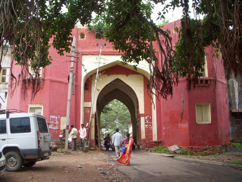
Figure 1. The Gate to Dohud Fort. [1]
The Bombay Presidency is generally stated in the history books to have by and large have avoided the worst of the outbreak. Such treatment in the history books as is afforded to the Mutiny in the Bombay Presidency concentrates almost entirely on the campaign Sir Hugh Rose.
With the recently improved access to the archives that the internet provides, and also the reports now available from the English regional newspapers from the time it is becoming apparent that the mutiny had had the potential to have spread very much further, had it not been for the efforts of a few comparatively junior officers who took exceptional steps that prevented the outbreak spreading in their districts.
One such officer was Captain Christopher Buckle who in 1855
"was appointed Assistant Political Agent Kattywar, and in the following year Acting Political Agent in Rewa Kanta, and held that post on the breaking out of the mutiny. Rebellion spread from Central India westward, and was threatening Goozerat. Fort Dohud, on the high road from Indore to Baroda was besieged, and Captain Buckle put himself into it in command of the available forces which he could collect in a hurry, with the result that the communications between Goozerat and Central India were maintained throughout the siege Delhi and the whole war. For his services during the mutiny in India Captain Buckle received the cordial thanks the Government Bombay, endorsed by the Government of India. At the battle of Oodeypoor, December 1, 1858, Captain Buckle commanded the cavalry forces, and was mentioned in Brigadier Parke's despatch the 6th." [2]
"The other letter from Dohud, and is dated 25th November:— Yesterday we had news from a place called Sintlam, half way between this and Neemuch. At a place called Mahidpore, belonging Holkar, the contingent mutinied, at least the Mussulman portion it did, and thrashed the remainder, who were staunch, taking the guns and magazine with them. The doctor and an officer were killed in the affray—the former, I believe, by his own native assistant. What a rascal! The ladies all escaped. The Mhow force went up to the place and gave the Mussulmans an awful beating. They killed 300 of them, took 150 prisoners, and got back the guns. The letter from Sintlam was dated the 19th, and the Mhow force were then at Mundesore, which was expected to be taken in two or three days. Mundesore is only twenty-four miles from Neemuch. At the latter place the slaughter had been immense. "
"6 p.m.—Another letter from the Neermuch direction gives authentic news that the mutineers had all left that place. They got a gun up on the top of a house and began to play on the fort. We got a 24-pounder to bear upon them, and knocked the house and gun to pieces. They then tried to charge, but a discharge of shrapnel killed 100 of them; and a mine of ours bursting in the right time killed 130 more. The name of Lieutenant Wellington Rose is mentioned the letter; so that if anything had happened to him, we should have certainly heard of it. We took two of their guns from them, which one good thing."[3]
One of the challenges when using 19th Century accounts of events is that it is often very hard to work out where they occurred especially if you are using modern maps like Google Earth. Fortunately Dohud appears in Walter Hamilton's East Indian Gazetteer, which has longitude and latitudes.
"This place stands on the common boundary of Malwa and Gujerat, at the north-east entrance of the Barreah jungle, which' extends above forty miles nearly to Godra, yet the road through it leading into Gujerat is the best and most frequented; lat. 22° 55' N., lon. 74° 20'E. Dohud is of considerable extent, the houses well built, and the bazar abundantly supplied with grain and water. It is in consequence much frequented by the traders of the interior, being a thoroughfare for the inland traffic between the provinces of Upper Hindostan and Malwa, with Baroda, Broach, Surat, and other large commercial towns of Gujerat. It is also of considerable importance on account of its position, which commands the principal pass into Gujerat from the north-east. The present fort of Dohud was a caravanserai at the eastern extremity of the town, said to have been built by Aurengzebe. It is 450 feet square, and has two strong gates, one on the north and another to the south, and the interior contains a mosque, two wells, and other handsome structures, all of excellent workmanship and durable materials.—"
These co-ordinates bring us to the modern town of Dahud and the fort or caravanserai is clearly visible.

Figure 2. Dohud Fort on Google Earth.
Hamilton records that the caravanserai had originally been built by Aurengzebe, and that it was 450 feet square.
This is confirmed below by a line drawn with Google Earths measuring tool with which I have traced a line 450 feet long onto a Google Earth image below.

Figure 3. A Google Earth image of Fort Dohud with a 450 feet line drawn in red on it.
An 1868 report describes this fort, and fits very well to the modern buildings.
"The Gaol consists of the east half of the fort, and the cells, 38 in number, are situated on its north, east, and south sides. The fort forms part of the northern boundary of the town, and is about 400 yards south of camp Dohud, the intervening space being used as a parade ground. In the west half of the fort the mamlutdar and moonsiff have their courts, and the sowars have their stables and houses. During the year the Gaol has neither been increased nor altered in any way." [5]
If you know anything about the fate of the people mentioned above, I would be very interested to hear from you.
I can be contacted at Balmer.nicholas@gmail.com
[1] http://www.panoramio.com/photo/91686181?source=wapi&referrer=kh.google.com photo by Maximilian Lepik
[2] From the obituary of Colonel Christopher Buckle, Worcestershire Chronicle - Saturday 13 August 1887.
[3]Inverness Courier - Thursday 31 December 1857.
[4]The East Indian gazetteer: containing particular descriptions of ..., Volume 1, By Walter (M. R. A. S.) Hamilton. Page 523. Published 1828.
[5] Annual Report on the Bombay Gaols, including Sind and Aden.. By Bombay Government, Published 1868. Page 228. This very detailed report includes numbers of prisoners, deaths and details of the diet and drainage in the fort.
No comments:
Post a Comment